Land use and land cover
Classification to distinguish between urban areas, vegetation, bare soil and water
1 Urban Atlas
The Land Use (LU) classification of the Urban Atlas (UA) was merged with information obtained from the local municipal authority, including nearby districts, to statistically analyze the LU characteristics. These classification were used to characterize each LU class’s basic urban features such as the fraction of buildings, streets, vegetation and bare soil (see below).

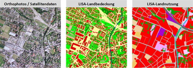
2 LISA
In addition, data from the Land Information System Austria (LISA) were used, which covered huge areas of Austria with a 1 m resolution. LISA provides extensive land cover data derived from satellite pictures from 2014 to 2016 and includes eleven distinct land cover types, such as buildings, steets, trees, annual crops, and cobblestone sidewalks.